A listing that says "sailboat access" in Port Charlotte can mean a lot can leave for Charlotte Harbor without checking a clock. It can also mean the boat has to time a tide, wait for a lock to cycle, and clear a fixed bridge that was never built with a mast in mind. Both lots get the same two words in the MLS description. The same phrase can refer to different boating conditions.
That distinction matters for buyers comparing Port Charlotte waterfront properties, because the price attached to "waterfront" here swings by six figures depending on which kind of waterfront it actually is. A buyer comparing two listings at the same price per square foot can be comparing two entirely different boating outcomes, and the listing sheet alone won't tell them which one they're getting.
One Phrase, Several Different Products
Port Charlotte was platted decades ago around an enormous canal grid, and the county's own tourism materials still describe the area as sitting on more than 165 miles of man-made waterways feeding into Charlotte Harbor and the Peace and Myakka Rivers. That scale is real. Access conditions vary across that grid.
Real estate professionals who work these canals daily describe the value spread bluntly: a home with true Gulf access and no fixed bridge in the way can sell for $100,000 to $200,000 more than a comparable dry lot a few streets over. That is not a rounding error. It is often the difference between two homes that look nearly identical in square footage, bed count, and finish level.
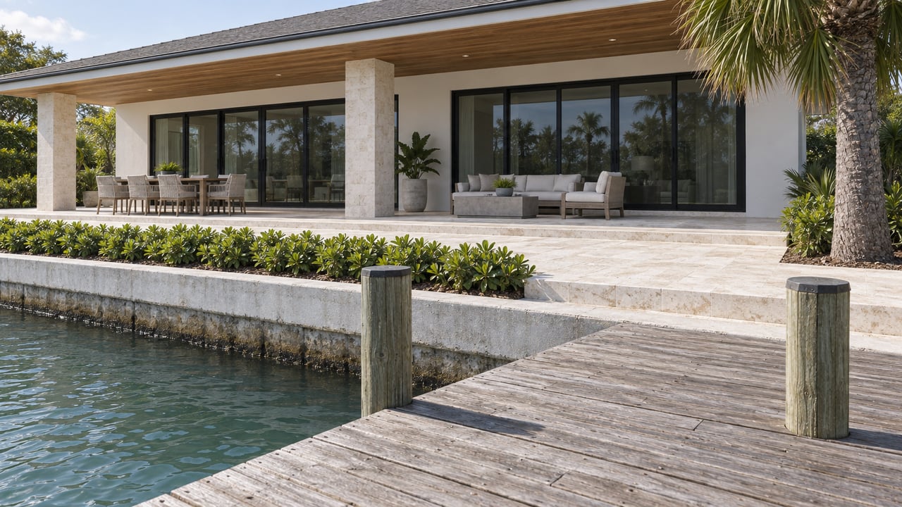
Inside that spread sits a second, quieter distinction that fewer buyers check before they write an offer: saltwater canal access to Charlotte Harbor is not the same product as true Gulf access with no bridge restriction, and neither of those is the same as a freshwater canal that dead-ends into a lake with no route out at all. A listing photo of a dock and a seawall looks identical across all three. The boat that can actually use that dock does not.
South Gulf Cove Access Details
South Gulf Cove sits within Port Charlotte's numbered platted sections, roughly Sections 8 through 23, and it is one of the most heavily marketed canal communities in the area. Charlotte County's own community plan credits it with 4,734 waterfront lots along a canal network that other descriptions of the same neighborhood put at somewhere between 50 and 55 miles, a spread that itself hints at how loosely these numbers get repeated from one source to the next.
Beyond the mileage, South Gulf Cove is widely marketed as a sailboat-friendly community, but published figures provide useful context: the fixed bridges along the route average 8 to 9.5 feet of clearance, and canal depths average around 5 feet.
The route out runs through the South Gulf Cove Boat Lock near the mouth of the Myakka River, just before the El Jobean bridge. Charlotte Harbor Boat Storage, a marina that services boats in that system, notes the lock is self-operated, with directions posted at the pedestal, and that the passage is tide-dependent for anything drafting five feet or more. The lock's operation and tide dependence are useful parts of the route for a buyer to understand.
None of this means South Gulf Cove is a poor boating community. Snook, redfish, tarpon, and trout fishing off private docks there is well documented, and for a center console or a pontoon the lock and bridge heights are rarely a problem. The issue is narrower and more specific: a buyer who owns, or plans to own, a sailboat or a taller center console with a hardtop, outriggers, or a radar arch needs to check the actual clearance and depth, rather than relying only on the general access label.
The Route Test Before You Write an Offer
Buyers can clarify the route by asking a few questions before writing an offer.
- Ask for the exact path from the dock to open water, described turn by turn, not just the canal name on the plat.
- Get every fixed bridge clearance along that path and compare it to the boat's full height above the waterline, including antennas, outriggers, T-tops, and radar arches, not just the hull.
- Ask whether a lock sits on the route, how it's operated, and whether it requires a scheduled window or runs on demand.
- Get a depth reading at the shallowest point of the route, not just at the private dock, and confirm whether that number was taken at high tide or low.
- If a community or listing uses the term sailboat access, compare it with the community's own rules, FAQ, or engineering notes. That label isn't regulated by anyone, so check the route details directly.
Charlotte Harbor itself adds one more variable worth knowing before that trip: the harbor's tidal range averages about 2 feet, but wind out of the west can push water levels as much as 5 feet higher than normal, which changes the math on a bridge clearance that looked fine on a calm day.
Why the Median Price Won't Sit Still
The same access differences show up in the pricing data, just in a less obvious form. Look at Port Charlotte's median home price across five different trackers, with reporting periods spanning late July through September 2026, and the numbers refuse to agree with each other. One tracker's three-month window ending in August 2026 put the median sale price at $276,000. Another's average home value as of the end of July 2026 came in at $268,990. A third's September 2026 median list price landed at $329,000. A fourth pegged the September 2026 median for single-family homes at $265,000. A fifth, using a rolling MLS window through early August 2026, put the median sale price at $300,000.
That is a $64,000 spread across sources describing the same city in the same stretch of 2026. Some of that gap is methodology, list price versus sale price, average versus median, three-month windows versus single-month snapshots. But a meaningful piece of it is almost certainly the access problem itself. When a data set blends dry lots, freshwater canal lots, restricted-access saltwater lots, and true no-bridge Gulf access lots into one city-wide median, the resulting number describes an average of very different products rather than any one of them accurately.
That is the practical lesson underneath all of this. A single median price for Port Charlotte was never going to tell a buyer much on its own, and now there's a documented reason why. The number that matters is not what the whole city sold for last month. It's what a specific route, from a specific dock, to open water, will actually support.
What This Means If You're Comparing Sections
For a buyer weighing a canal lot against a dry lot at a similar price, the water access is usually doing more of that price work than the finish level of the kitchen. For a buyer comparing two canal lots at similar prices, the real comparison isn't the dock or the seawall in the photos. It's the bridge clearance and lock schedule between that dock and Charlotte Harbor.
For a seller, the same logic runs in reverse. If a lot has genuine no-bridge Gulf access, that's a fact worth documenting clearly rather than leaving to a generic phrase that a buyer might discount out of habit, because the phrase alone may not describe a buyer's specific route.
If you're comparing a canal lot in Port Charlotte against another one and the boating route matters to how you'll actually use the property, it's worth having someone check the bridge heights and lock hours before you're deep into a contract, not after. Team Double Decker can look at that route with you, aerial footage included, so the water access you're paying for is the one you'll actually get to use.
This article is general information, not legal, tax or financial advice. Consult a qualified professional about your situation.